
As spring gives way to fire season, legislators are regularly briefed on fire danger, firefighting readiness, and the cost of putting out the flames. The Environmental Quality Council discusses fire factors at a meeting this week. But all Montanans have access to fire danger information, including two reports that look at community and individual risks of fire.
Wildfire Risk to Communities, created by the Forest Service, is a website with interactive maps, charts, and resources to examine wildfire risk. It is searchable by state, county, or town.

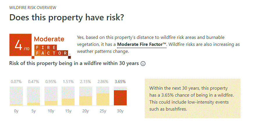
A recently released report by a nonprofit organization drills down even further. The 5th National Risk Assessment: Fueling the Flames, by the First Street Foundation uses recent wildfires and changing environmental conditions. It allows a user to look at the risk to a specific property. For example, a home near the state Capitol shows an increasing risk of fire over the next 30 years. This link provides individual property searches.
The report also shows statewide information for Montana and other states. And while many fires in Western Montana garner the most attention, the report shows Yellowstone County as having the most properties at risk today. And in 30 years, it predicts that the percentage change in properties at risk is greatest in Fallon and Wibaux counties.

